


tour du lac de Saint Cassien

PEBREJOSIANE
User
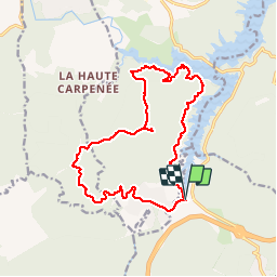

Length
17.4 km

Max alt
346 m

Uphill gradient
424 m
Km-Effort
23 km

Min alt
110 m

Downhill gradient
424 m
Boucle
Yes
Creation date :
2018-04-17 22:55:19.762
Updated on :
2018-04-17 22:55:19.762
5h22
Difficulty : Easy

FREE GPS app for hiking
 SityTrail
IGN / Geographical institutes
SityTrail Plus
The world is yours!
About
Trail Walking of 17.4 km to be discovered at Provence-Alpes-Côte d'Azur, Var, Les Adrets-de-l'Estérel. This trail is proposed by PEBREJOSIANE.
Description
rando sur pistes très agréable
Positioning
Country:
France
Region :
Provence-Alpes-Côte d'Azur
Department/Province :
Var
Municipality :
Les Adrets-de-l'Estérel
Location:
Unknown
Start:(Dec)
Start:(UTM)
321783 ; 4824523 (32T) N.
Comments